
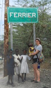
Ferrier, Haiti city line
Ferrier (Haitian Creole: Ferye) is a small town contained within the Fort-Liberté Arrondissement, part of the Northeast Department of Haiti. It is Haiti's northeasternmost commune.

History[]
At the time of Indian Ferrier was called "Maribahoux". Later, it was called Ferrier-Lasale, a name corresponding to that of a former owner. Ferrier, before being elevated to the rank of commune, was dated in 1839 a district of the old Fort-Dauphin, former name of the commune of Fort-Liberté. Ferrier was established as a section in 1932 and was granted municipal status in 1946.
• On May 7, 1911, Ferrier and Capotille took up arms against President Antoine Simon at Ravine-Baptiste, a position located near Ouanaminthe.
Geography[]
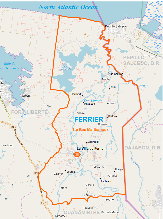
According to the IHSI, the commune has a total area of 70.00 square kilometers (27.03 square miles), of which 68.92 km² (50%) is rural, 48% is suburban, and 1.08 km² (2%) is urban. The commune of Ferrier has one only communal section and its land area consists primarily of plains.
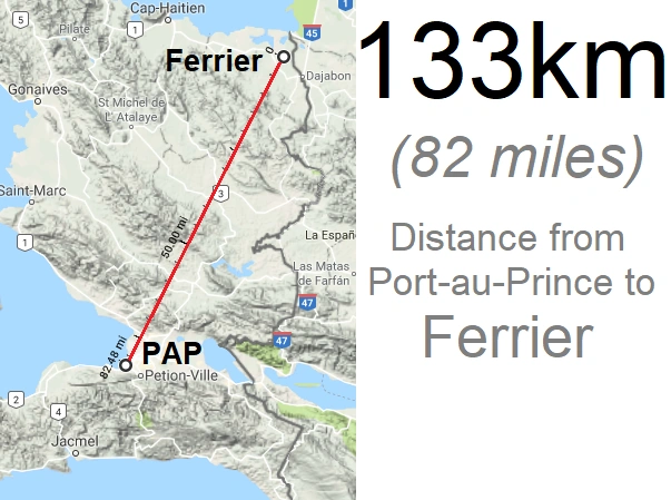
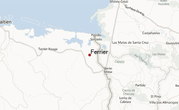
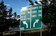
Ferrier is located at 19.6172° N, 71.7815° W. The town's eastern border is the international boundary line. It is bordered on the north by the Bay of Mancenille, on the east and southeast respectively by the Dominican towns of Pepillo-Salcedo and Dajabón, on the south by the city of Ouanaminthe, and on the west by the city of Fort-Liberté. The town's population is mostly concentrated in the center, La Ville de Ferrier, and its villages, Merande, Bossous and Artaud.
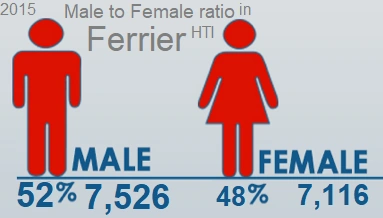
Demographics[]
The inhabitants call themselves Ferrois / Ferroises.
| Population | Change | Year |
|---|---|---|
| 1998 | 12,605 | |
| 2009 | 13,315 | +6% |
| 2015 | 14,642 | +10% |
  |
The distribution of the municipality's population by major age group has the following structure:
41% of its population is under 15 years old,
52% of its population represent people aged 15-64, and
7% are aged 65 and over
Climate[]
Ferrier has a tropical savana climate, according to the Köppen-Geiger climate classification, typified by rainy summers.
This climate is considered to be Aw. The average annual temperature in Ferrier is 26.2 °C (79.2°F). The average annual rainfall is 1032 mm (41 inches).
Economy[]

In terms of economic and financial infrastructure, the municipality has only one credit union, a business house, three borlette banks and 20 gatehouses.
Agriculture, trade, livestock and fishing are the main economic activities of the municipality. Two food supply centers and three depots form the commercial establishments. The town has no petrol station and private morgue, but it has two pharmacies located in the health centers. Much of the shopping is done at its main market of Nan Pont.
Farmers in Ferrier engage in sustainable farming. They produce oranges, tobacco, and limes, as well as livestock, to provide for themselves. The land in Ferrier is inadequately irrigated, but is a good place to grow rice, and has received funding from non-government organizations (NGO) to do so.
Ferrier, located in Northeast Haiti.
Infrastructure[]
Transportation
Infrastructure in Ferrier is underdeveloped. Road systems barely exist and footpaths are very popular, as indicated by the red dashes on the map. The nearest airport is Cap-Haïtien International Airport.
Route Nationale 6 skirts the town's southwestern border for about 1 kilometer.
Education
At the time of the census, a preschool, 22 elementary schools and 4 secondary schools had been counted for a total of 27 schools. No preschool and primary school has been identified in the rural areas. The educational infrastructure of the municipality also includes two technical and professional institutions.
Health
The Ministry of Public Health and Population is not represented in the commune of Ferrier. Two auxiliaries and three health workers train the health staff of the commune. The municipality has a dispensary. To get medical attention, residents must get to the nearest medical facility located 50 km (30 miles) out of town in Milot.
Utilities
For water availability, the town of Ferrier has nine rivers, two springs, a lake, eight lagoons and public fountains with close to thirty pumps and faucets.
The commune Ferrier is electrified by the power station of Carrefour Chivri. Some places like Ferrier Center and the town of Meillac are also electrified by means of solar panels.
Administration
As of December 2021

Parish of Ferrier
  François Placide |
  To be announced |
  Johny Joseph |
| Party:Truth |
The town has a tax office, a police station a custody room, a court, and a civil status office.


")
")
")
")
")
")
")
")
Culture[]
Religion
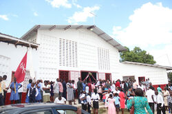
Nearly 19 churches (chapels and temples included) have been inventoried in the commune of Ferrier. The patron of the municipality, Saint Charles Borromée, is celebrated every November 4th.
Organizations
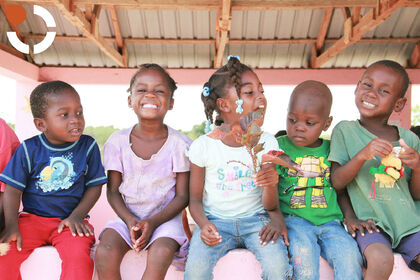
There is no political representation in the commune. However, three grassroots organizations, five farmer groups, five women's groups, two non-commercial cooperative centers, an international organization and three NGO's were identified. During the aftermath of the 2010 earthquake, a population of several hundred survivors fled to Ferrier. They were originally from Ferrier and had migrated to Port-au-Prince seeking work. In an effort to ease the burden of accommodating the dramatic increase in Ferrier's population, NGOs have been working proactively to convince the returnees to take up rice farming. They are supporting them with food and money, putting them to work in rice fields, in order to give them a means of income.
Communication
At the time of the inventory, apart from a postal office, the commune had no telephone. There was also no radio station, newspaper / magazine, TV station etc.
Leisure
The town of Ferrier has very few places of entertainment. There are three gaguères, a public square and three spaces for playing football (soccer), volleyball and basketball.
The town also has a library and a cinema. However, there is no museum or theater. For cultural heritage, the town has at leastst four monuments and colonial sites.
Neighboring sections
| 〰️North〰️ Manzanillo Bay |
Upper East Pepillo-Salcedo, D.R. | |
|---|---|---|
| West 1re Dumas, FTL |
Ferrier |
|
| South 1re Haut-Marihaboux, OUA |
Lower East Dajabón, D.R. |
References[]
Ferrier, originally named Maribeaux - [1]
Ferrier - [2]
Ferrier - [3]
Michael Vedrine