"Bay kou bliye, pote mak sonje."
He who strikes the blow, forgets; he who bears the bruises, remembers."
-A Haitian proverb
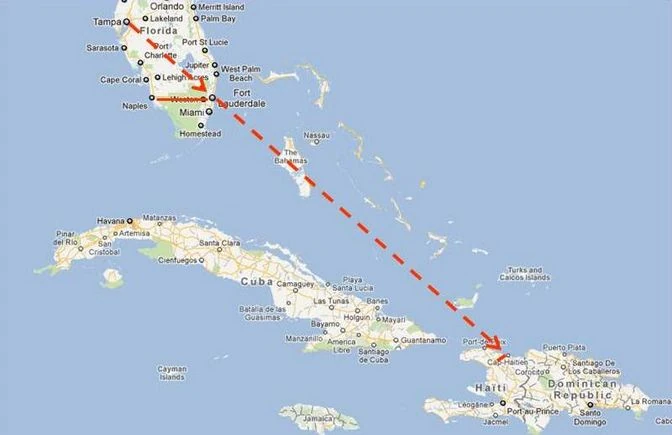

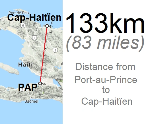
Location in proximity to Florida

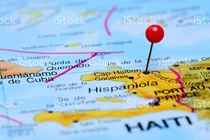
Location in Haiti
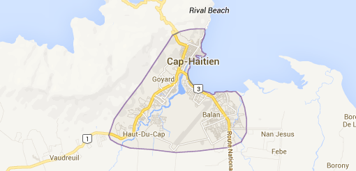
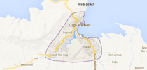
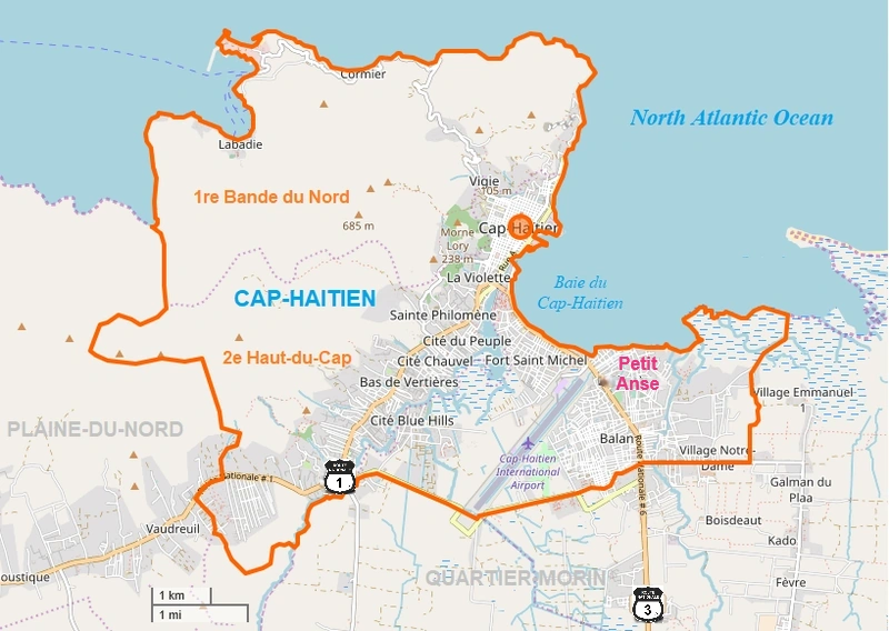
City limits
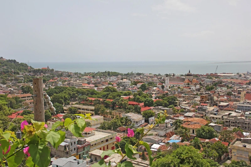
Cap-Haïtien (or Le Cap) (pronounced 'Cap-Hay-Shen') is a city of about 275,000 people on the north coast of Haiti.
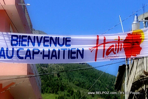
"The Capital of the Northern Region", officially and often known by its nickname Au-Cap, is the cultural, financial, and commercial center of Northern Haiti. Widely regarded as Haiti's "second city", it is actually the sixth most populous city in Haiti (after Gonaïves), and the most populous city in the Northern Department. Located in a large coastal basin surrounded on three sides by mountains reaching up to and over 2,000 meters (6,000 feet), Cap-Haïtien covers an area of about 44 square kilometers (21 square miles). The city is also the seat of Cap-Haïtien Arrondissement, the 7th most populated arrondissement in the country.
Cap-Haïtien is the anchor of Haiti's Northeast Corridor, the geographical region stretching from Cap-Haïtien to Ouanaminthe, with 650,000 inhabitants.
Cap-Haïtien is also the capital of Northern department and Haiti's third most populous state capital. Due to its proximity to wide Caribbean beaches to its northwest, Cap-Haïtien has traditionally been a resort and vacation destination for Haiti's upper classes. In 2013, Cap-Haïtien came in at No. 5 on MondoBlog magazine's, annual top-ten list of the "most beautiful communes" of Haiti.
About[]
Pre-colonial history
The Cap-Haïtien coastal area was settled by the Taíno Amerindian tribes. Cap-Haïtien would eventually be founded on the village of Guarico. Guarico was the seat of Marién, one of the original five kingdoms that formed the Taíno homeland of Hispaniola. Marién was ruled by chief Guacanagaríx, the first chief to welcome Christopher Columbus and to convert to Christianity.
Spanish contact
East of this city, Christopher Columbus built a fort named La Navidad with the debris of Santa María, shipwrecked on the Christmas Eve of the year 1492. He left behind 39 of his men, who, before the return of Columbus, were all killed by the natives exasperated by their exactions. The fort, which had been burned down, will never be rebuilt and was forgotten until some remains were discovered by a local in 1977.
History[]
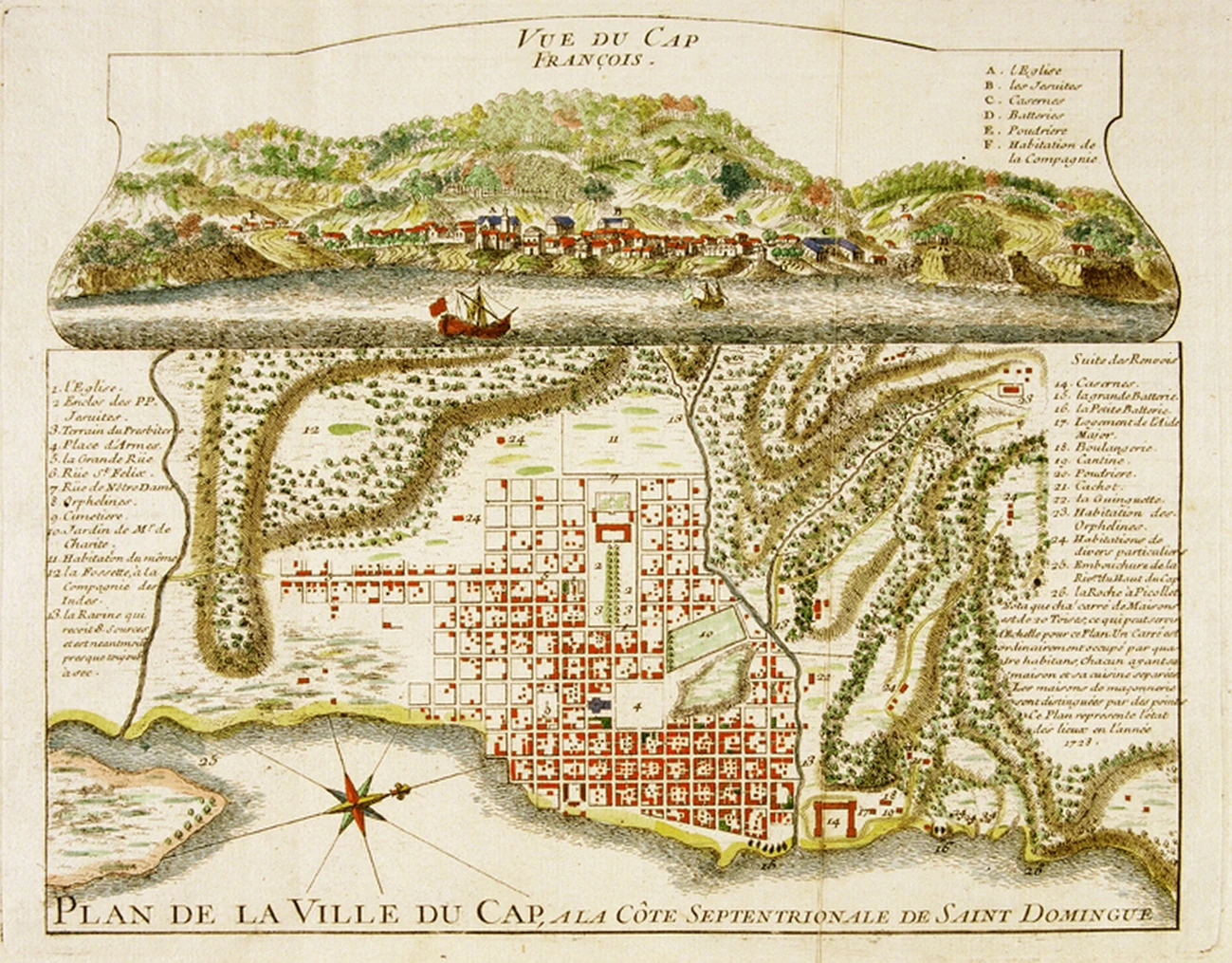
Historic Map of Le Cap
The city of Cap-Haitien was founded in 1670 under the administration of Governor Bertrand d'Ogeron during the French colonial period. This important city is located on the middle of the coast of the Northern Plain. Not long after the French took over the western half of the island from Spain, it became the colonial capital of the French colony of Haiti (Saint-Dominique). It was recognized as a city by the royal decree of 1711 and soon after became the economic capital of the colony. It successively bore the name of Cap-Français or Paris de Santo Domingo from the time of the colony, Cap-Henri during the reign of Henri Christophe and Cap-Haïtien after the war of independence. Later, when General Henri Christophe was crowned king, he named it Cap Henry. This denomination ceased with his reign, and since that time she has taken the name she still wears today. Its first inhabitants were pirates coming from la Tortuga. In the early days, they had much to suffer from the incursions of the Spaniards, who sought to ruin their establishments; but as the fledgling colony grew stronger, the Cape also grew and, before the French Revolution, offered the appearance of a well-built town, which became the center of commerce and proportionate luxury to the riches of its inhabitants. It became known as the richest colony of the 17th century due to it being located in the center of where half of the world’s sugar was produced. This was achieved with heavy exploitation of slaves imported from Africa. Cap-Francais was known as the 'Paris of the Caribbean' . Raised to the rank of commune in 1804, Cap-Haïtien has three communal sections and a district.
The law of November 20, 1821, fixes the precise distance from this commune to the capital at 60 leagues.
Timeline[]
A ferry used to connect the military post at Petite Anse on the Upper Cape River. The government of General Boisrond Canal had an iron bridge placed there, which was inaugurated on June 20, 1877. The government of President Saloman had bought from the builders (1887) this bridge on which the State does not levy tolls.
• In May 1695, Le Cap was attacked and pillaged by the British, in retaliation for the Jamaica expedition led in 1694 by Jean-Baptiste du Casse.
• In 1739, Fort Picolet was built, consisting of two stacked batteries, a walkway and a wall along the coast. Nearby there are other fortifications: Fort Magny (in which General Magny is buried and defended by batterie du Gris-Gris), Fort Belly, Fort-aux-Dames and Fort Saint-Joseph.
• The population reached 15,000 inhabitants in 1790.
• The city was burned for the first time from June 21 to 23, 1793 during a Franco-French clash between Republican troops and white separatists.
• On February 5 or 6, 1802, during the unloading of the Santo Domingo Expedition, General Henri Christophe, facing French military superiority by a scorched earth policy, allegedly unleashed the fire that destroyed the city in its entirety.
• On October 1802, the insurgent bands of Petit Noël Prière, assisted by those of Pétion and Clerveaux, came to camp around Cap-Haïtien. Christophe came to join them. The whites of the city then engaged in the most frightful carnage, killing and massacring black and yellow, while twelve hundred men of the 6th colonial were drowned in the harbor. Leclerc immediately ordered the concentration in Cap-Haïtien of all the troops stationed in the west and east of the city.
• The following 28th of October, Cap-Haïtien was besieged again by the native revolts. General Leclerc, on his deathbed, ordered General Clauzel to occupy only the city wall to defend himself better. The natives were camped less than a league from the gates of the city. On the November 1st, Leclerc died of yellow fever in the Cape, at one o'clock in the morning, and deigned General Rochambeau to succeed him. Pauline Bonaparte had the body of her husband embalmed, who, after having received funereal honors, was embarked for France on the ship le Swiftsure and on which she accompanied him. The Pantheon received the remains of Captain General Leclerc.
The city
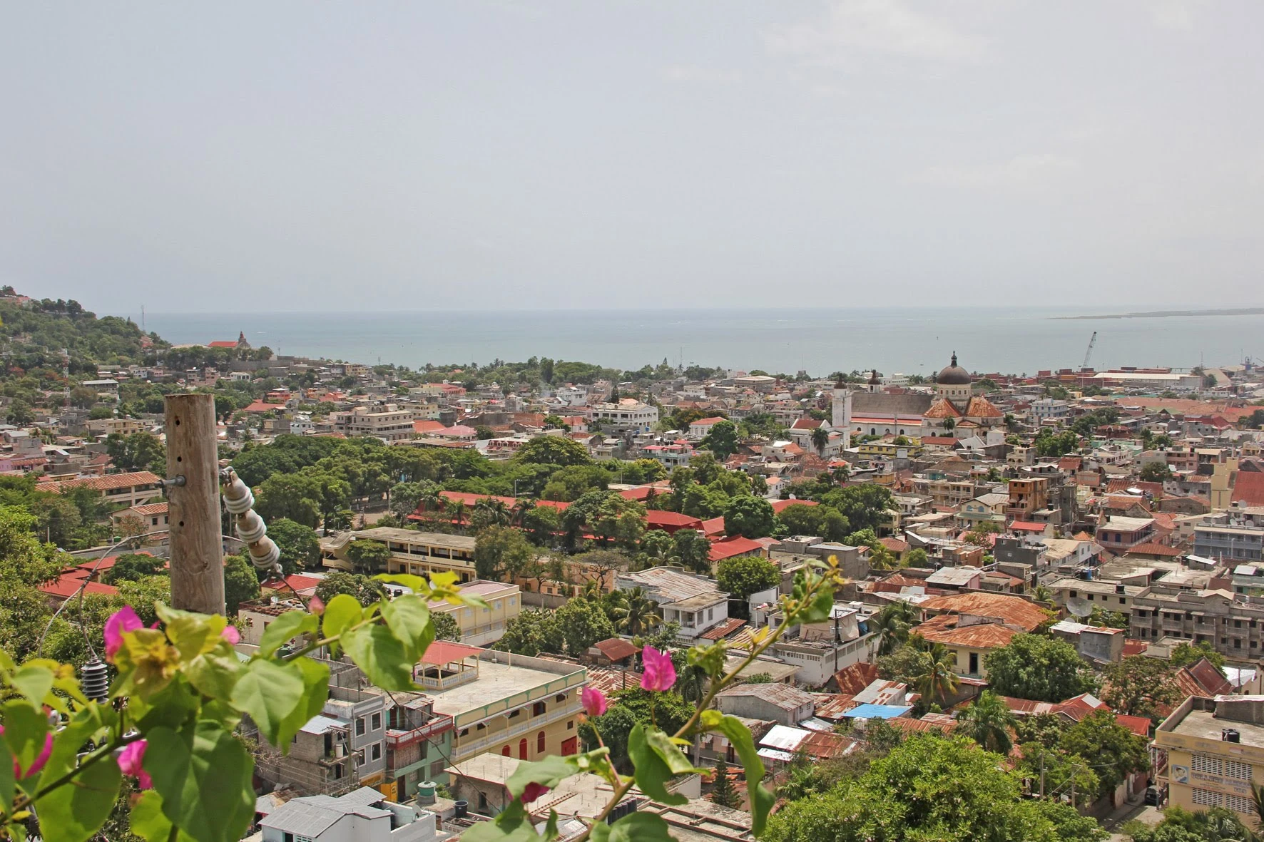
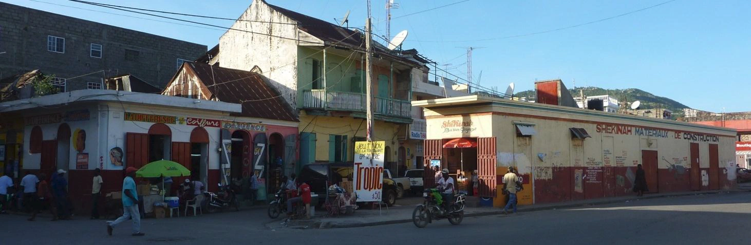
The central area of the city is located between the Bay of Cap-Haïtien to the east, and nearby mountainsides to the west, which are increasingly dominated by flimsy urban slums. The streets are generally narrow and arranged in grids. As a legacy of the US occupation of Haiti from 1915-1934, Cap-Haïtien's north-south streets were re-named as single letters (beginning with Rue A, a major avenue), and its east-west streets with numbers. This system breaks down outside of the central city, which is itself dominated by numerous markets, churches, and low-rise apartment buildings (3-4 floors each) constructed primarily before and during the US occupation. Many such buildings have balconies on the upper floors which overlook the narrow streets below, creating a an intimate communal atmosphere during the Haitian dinner hours.
Cap-Haïtien is also the nearest sizeable city to the historic Haitian town of Milot, which lies 12 miles to the south along a gravel road. Milot was Haiti's former capital under the self-proclaimed King Henri Christophe, who ascended to power in 1807, three years after Haiti had gained independence from France. As a result, Milot hosts the ruins of the Sans Souci palace, wrecked in an 1800's-era earthquake, as well as the massive Citadelle Laferrière, an immense stone fortress bristling with cannons. The Citadelle is located five miles from Milot, atop a nearby mountain.
Geography[]
Cap-Haïtien is a port city located on the Haiti's northern coast and was considered in the nineteenth century as the Haiti's safest port. The city lies on the west coast of Cap-Haïtien Bay, at the mouth of the Haut-du-Cap River and is dominated by the mountain Morne Jean which rises to 718 meters above sea level. To the west of the agglomeration of Cap-Haïtien lies the deep Acul Bay.
This coastal city is largely dominated by plains and has a tropical climate.
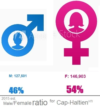
Demographics Its inhabitants are called Capois.

| Year | Population | Change |
|---|---|---|
| 1790 | 15,000 | |
| 1890 | 35,000 | +133% |
| 1950 | 29,190 | -17% |
| 1971 | 60,448 | +107% |
| 1982 | 64,406 | +7% |
| 1992 | 92,100 | +43% |
| 1998 | 128,973 | +40% |
| 2003 | 111,094 | -14% |
| 2009 | 155,505 | +40% |
| 2015 | 274,404 | +76% |

Neighborhoods[]
| CAP | Cap-Haïtien | 274,404 | ||||
|---|---|---|---|---|---|---|
| VCH | Ville du Cap-Haïtien | 170,994 | ||||
| QPA | Quartier de Petit-Anse | 98,042 | ||||
| BNO | 1ère Section Bande-du-Nord | 23,256 | Bel-Air, Cormier, Doco, Ducroix, Falaise, Fort-Bely, Georges, Grand-Doco, Labadi, La Fague, Plateau-François, Poirier, Saint-Martin, Vigie. | |||
| HCP | 2ème Section Haut-du-Cap | 150,176 | Barière-Bouteille, Bréda, Camp-Fort, Charrier, Fort-Durocher, La Coupe Brada, La Voûte, Patasson, Vertières. | |||
| PAS | 3ème Section Petit-Anse | 2,930 | Balan, Bruno, Charut, Haut-du-Cap, La Petite Anse, Magaeline. |
Climate
The prevailing winds in the Cape area are east, north, and southwest winds. Northern winds bring cold and humidity from October to March. Westerly winds are heavy, hot and humid; they have the most painful impression of warm climates. A southerly wind, as in Puerto Plata, coming from the ground, blows during the night. Since its foundation it has been experienced by many hurricanes, including those of August 14, 1680, August 13, 1765, and September 27, 1785.
The rains fall from October to April; dry weather lasts from May to September. On average, Cap-Haïtien receives 1,407 mm (55 inches) of rain per year. The Great North River flows south of the bay and the river at Gravois east of the mouth of the Grande Riviere.
The mountains of Cap-Haïtien are quite isolated from the other mountain groups of the island. They stretch between Acul Bay and the city of Cap Haitien. Cape Morne begins at Le Morne Rouge, east of Acul Bay, and extends to Picolet, 15.6 km (10 miles) in a straight line. The highest point is in the middle of the Loumeau habitation, at 709 meters (2,326 feet) above sea level. There is also the Morne of Vigie (293 meters 961 feet) and that of Lory. In 1891, the government of President Hippolyte granted Mr. Etienne the concession of the water supply service in the city of Cap-Haïtien.
Infrastructure[]
Transportation
The small Cap-Haïtien airport, located on the southeast edge of the city, is currently served by several small domestic airlines, and is patrolled by Chilean UN troops. International service to Ft. Lauderdale, Florida is provided five days per week by Lynx Air International.
The port of Cap-Haitien can contain a large fleet. It is in the most beautiful part of the island. Its waters are safe and deep, seeing up to 600 ships of all sizes. It is open to foreign trade. The entrance to the harbor is difficult and the help of the pilot must always be claimed. When the pilot takes the ships a league off the Picolet, they pay.
A naval shipyard established in the Cape, but long gone, had already supplied several ships to the State, including a beautiful brig. Today only ships are being built for cabotage. The bay of Cap-Haïtien is located between the tip of Caracol and that of Picolet.
Education
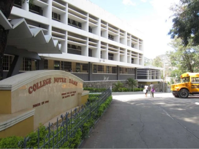
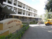
College Notre-Dame
The King Henri Christophe University, a new campus of the State University of Haiti, was inaugurated on January 12 , 2012 in Limonade after more than 17 months of work (first stone laid on July 31, 2010). Funded by the Dominican Republic, it is to host 10,000 students in what will be considered Haiti's most modern university infrastructure. It will consist of several three-story buildings comprising: 72 classrooms for 30 students each, a library, meeting rooms, computer labs, accountants, scientists, as well as academic, administrative and recreational facilities.
There are several other private public universities in Cap-Haïtien. Such as Notre Dame University of Haiti, the Franco-Haitian University of Cap-Haitien, the University King Henri Christophe, Antenor Firmin University, the Public University du Nord - Cap-Haitien, the Faculty of Law, management and economics of Cap-Haïtien, and so many others.
The Ministry of National Education of Youth and Sports is represented in the commune by a departmental directorate. The distribution of schools is as follows: twenty-three Kindergarten, primary schools are 29 public, numerous private, and congregational. At the secondary level, there are 5 public schools and numerous private and congregational schools. In addition, the town of Cap-Haitien contains 8 vocational schools, five 5 private universities and seven other colleges.
Health
The Ministry of Public Health and Population is represented in the commune by a departmental office. As a provincial town, Cap-Haïtien is privileged with regard to health services. It enjoys access to quite satisfactory primary health care. This department is, according to the state results, among the best served in basic health care provision, with a service level above the average.
Utilities
Regarding water availability, the municipality of Cap-Haïtien has one river, seven springs and a lagoon. The water distribution system built in 1922 was extended throughout the municipality in 1952: the storage tanks are very old two for example date from 1896 and most are out of service. Other water features include three artesian wells, a number of traditional colonial-type wells, and public fountains with twenty taps and pumps. The entire city of Cap-Haitien is electrified.
Security
At the level of the administrative and judicial infrastructures, the commune has a police station and two sub-police stations. A court of appeal, two peace tribunals and one a registry office were also listed. The garrison of the commune is composed of the 2nd and 30th line infantry regiments, this last instituted in 1822, of the 1st battalion of the 1st line artillery regiment, of the national guard on foot, of an administrative police company and the rural police.
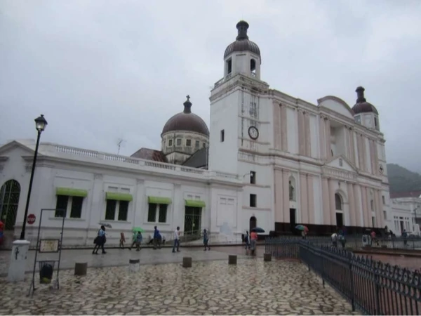
Cap-Haïtien, Haiti
Culture[]
Religion
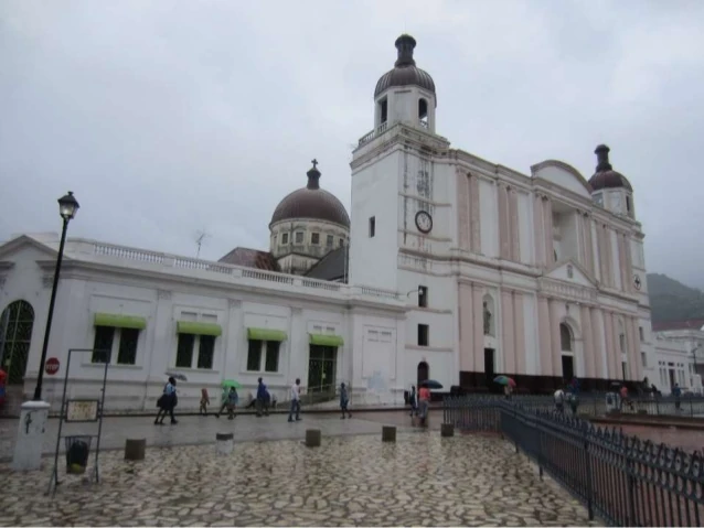
On the side of religion, 44 churches (chapels and temples included) were listed in the City of Cap-Haïtien.
The Masonic lodges of Cap Haïtien are: the Haitian No. 6, the Humanity No.26 and the Revival No. 50, under the Grand Orient of Haiti.
Organizations
Data on political representations, popular organizations, etc. are not available. Six non-governmental organizations with headquarters in the city of Cap-Haïtien and one international organization have been identified.
Communication
In terms of communication, the municipality has a telephone exchange,12 radio stations, 2 television stations and a newspaper / magazine.
When the post office was established in 1826, two couriers departed from the Cape every Monday and Thursday, one for Port-au-Prince and the South via Plaisance, and the other for the Northeast.
Social cohesion
Top four issues that generate conflict in the city:
Sovereignty, poverty, insecurity and crime
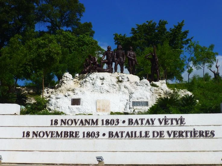

Heros de Vertieres; Cap-Haïtien, Haiti
Leisure
With regard to leisure, the commune of Cap-Haïtien has two libraries, four theaters and five cinemas. The old museum that existed until the 70s-80 no longer exists. The sports practiced are football (soccer), volleyball, basketball, tennis, athletics, judo, and karate, amongst others.
The walled Labadie beach resort compound is located six miles to the city's northwest, and serves as a brief stopover for Royal Caribbean cruise ships. It is connected to Cap-Haïtien via an unimproved and mountainous dirt and gravel road.
Twin towns and Sister Cities[]
Cap-Haïtien currently has three sister cities:
Fort Lauderdale, Florida, United States
Portland, Maine, United States
Columbia, Maryland, United States
Notable residents[]
The tomb of Sylvain Salnave, President of Haiti, and that of General Etienne Leo, who had commanded the district, are placed in Camp de Mars, in the shadow of the palm tree of freedom. The deputy Saint-Martin, who was expelled from the House on August 30, 1822, during the Darfur affair at Port-au-Prince, represented the commune of Cap-Haïtien.
Here are the names of the most illustrious children of Cap-Haïtien: Queen Marie-Louise, wife of Henri Christophe I, King of Haiti. Sylvain Salnave, Pierrot, Hippolyte, Presidents of Haiti. Generals Magny, Etienne Leo, Nord Alexis, B. Monpoint, Tiresias Simon Sam, Séide Thélémaque, former commanders of the district. Demesvar Delorme, one of the most brilliant Haitian writers, a leading speaker who represented his commune several times in the Chamber of Deputies, was Minister Plenipotentiary and Envoy Extraordinary to the German Government. V. Dejoie, Cassius Daniel, Evariste Laroche, Jean-joseph Dalbemar, Francois Manigat, J.B.N. Desroches, Jeune Belliard, Saint-Martin Dupuy, Antenor Firmin, and Steward, were secretaries of state. Pierre-baptiste Léveillé, J.B. Bins, Count of St. Victor, Baron Vastey, Demesvar Delorme, and Antenor Firmin have illustrated their names by works of high literature. Milscent and Oswald Durand are Cape poets. The first perished victim of the earthquake of May 7, 1842; the last represented his commune in the Chamber of Deputies.
Development issues[]
Protect the plain against the extension of the city
Protect the historic center
Structuring the growth of the city
Find the river and the coastal strip
Develop port infrastructures
Build the RN1 / RN3 link and a train station
Unclog the entrances of the city
External link[]
- short article - Columbia encyclopedia
")
")
")
")
")
")
")
")
")
")
")
")
")
Michael Vedrine