"Anpil ti patat fè chay."
A lot of small potatoes make a load.
-Haitian proverb
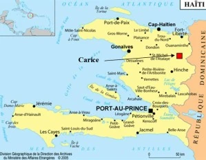
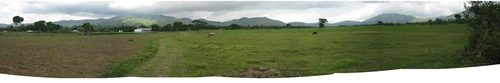
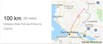
Carice (Kreyòl: Karis) is a remote town in the Northeast Department of Haiti and on the western border of the Dominican Republic, approximately 100 km (60 miles) northeast of Port-au-Prince and 35 km (22 miles) south of the Atlantic Ocean. It was incorporated in 1950. It is situated along the east bank of the Libon River in the Northern Massif Mountain Range, an extension of the Cordillera Central. The population was 13,615 at the 2015 census. Historically a coffee-growing region, it has long since been relatively rich in water. It is part of the Vallières Arrondissement and the Greater Ouanaminthe metropolitan area.

About[]
Location in Haiti
Originally the first communal section of Vallière, the commune of Carice was created by the Decree of the Northern Provisional Government in July 1889.
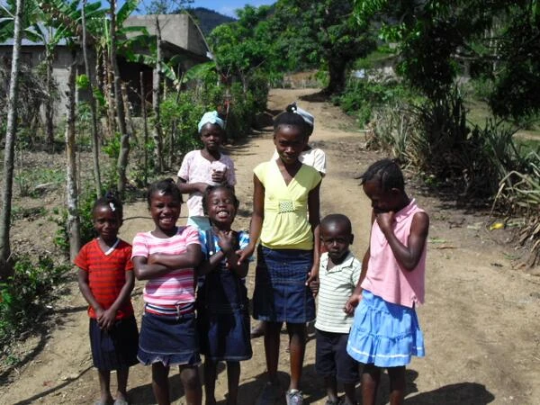
Carice, one of thirteen Northeast Department communes has two communal sections. It is interior, its dominant relief is plains and its climate is cool. Its inhabitants bear the name of Caricien/ne.
The village is of little importance, from the point of view of the population.
History[]
• In 1791, M. de Thouzard, a white colonist, distinguished himself by a speech delivered at the colonial assembly in favor of the full emancipation of free people of color. The Thouzard habitation is named after him.
• On January 8, 1889, Carice detached from the party of the Nordistes and made its submission to the Government of the President Légitime.
• The first citizen who represented this commune to the Constituent Assembly sitting in Gonaïves, is named Jonathas Edouard Etienne.

Sonrisas de Carice, Haiti
Savanne-Salee, Carice, Haiti
Geography[]
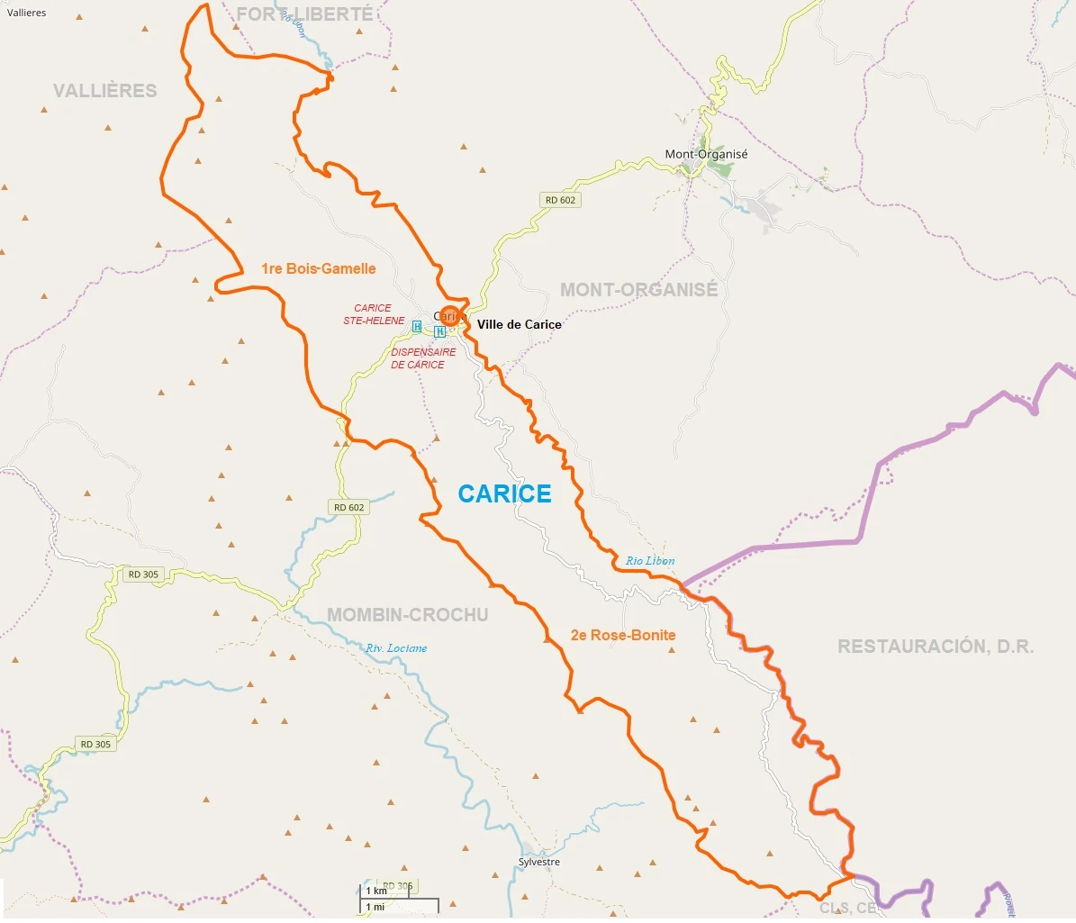
According to the IHSI, the town has a total area of 55.97 square kilometers (21.61 square miles), of which 32.65 sq.km (58%) of it is rural, 22.39 sq.km (40%) is suburban and 0.93 sq.km (2%) of it is urban. The town is bordered by Fort-Liberté to the north, Mont-Organisé to the east, the Dominican town of Restauración to the southeast, Cerca-la-Source to the south, Mombin-Crochu to the west, and Vallières to the northwest. Notable villages in the town include Carice proper, on the town's eastern border; Cigarra, towards the north, in the Bois-Gamelle section of the town; and Nan l'Etat towards the town's southern border.
The municipalities of Carice and Mont-Organisé have a similar configuration. They form a more or less homogeneous unit dominated by plateau areas. The areas covered in these communes have allowed several types of environments to be distinguished. Such as,

The lagoons. These are areas of lowlands that are supplied with water by springs. This environment is found in both Carice and Mont-Organisé. Rainfed rice dominates this environment; however, cane can also be found.
A plateau area. It is a vast area of great discovery with the exception of coffee-based agroforestry pockets. Red soils of the ferralitic type are encountered. This environment is found in the sections of Bois-Gammelle and Rose-Bonite in Carice and Savanette in Mont-Organisé. The cultivation of coffee is in net regression. Where it is practiced, it is associated with banana under cover of fruit and forest trees. On the whole, beans, yams, cassava, and maize are widely grown.
A wet mountain area. This environment has good productive potential because of the relatively high rainfall. Ferralitic red soils are observed in this environment. An agroforestry system based on coffee exists at this level, but its extension is limited. The coffee has a very low density and is associated with banana under cover of fruit trees and forest. Open spaces include cassava, beans, yams, and sweet potatoes.
Neighborhoods[]
| CAR | Carice | 13,615 | |||
|---|---|---|---|---|---|
| VCR | Ville de Carice | Urban | 4,711 | ||
| 1ère Section Bois-Camelle | Rural | 2,516 | Bois Gamelle, Cigarra, Eau-Garice, Face-Au-Nord, Savane-Salée. | ||
| RBN | 2ème Section Rose-Bonite | Rural Section | 6,388 | Albert-Derina, Carice, Carrefour, Cesar, Francois-Pierre, Moïse, Morne-à-Tuf, Nan Gustin, Nan l'Etat, Nan Vilmé, Wacacou. | 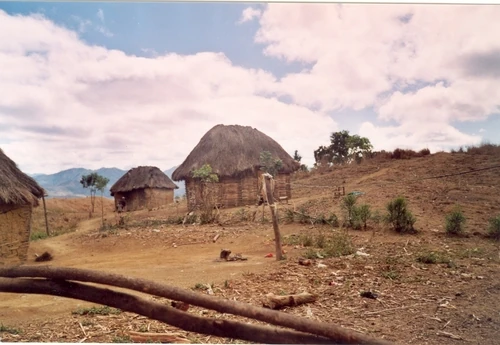  Section Rose-Bonite |
Demography
| Year | Population | |
|---|---|---|
| 1890 | 7,000 | |
| 1998 | 11,871 | |
| 2003 | 10,180 | -14% |
| 2014 | 13,408 | +32% |
| 2015 | 13,615 | +2% |
Economy[]
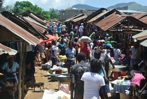

Marché à Carice
Economically and financially, the municipality of Carice is very lightly endowed. There are no banks, hotels, or gas stations.
Carice is a rural area without as many sources of livelihood as in cities and industrialized towns. This is why people rely on agriculture for their main livelihood. Farmers in the town mostly harvest mangoes, bananas, and coffee, which are considered the main and most popular products in the area.
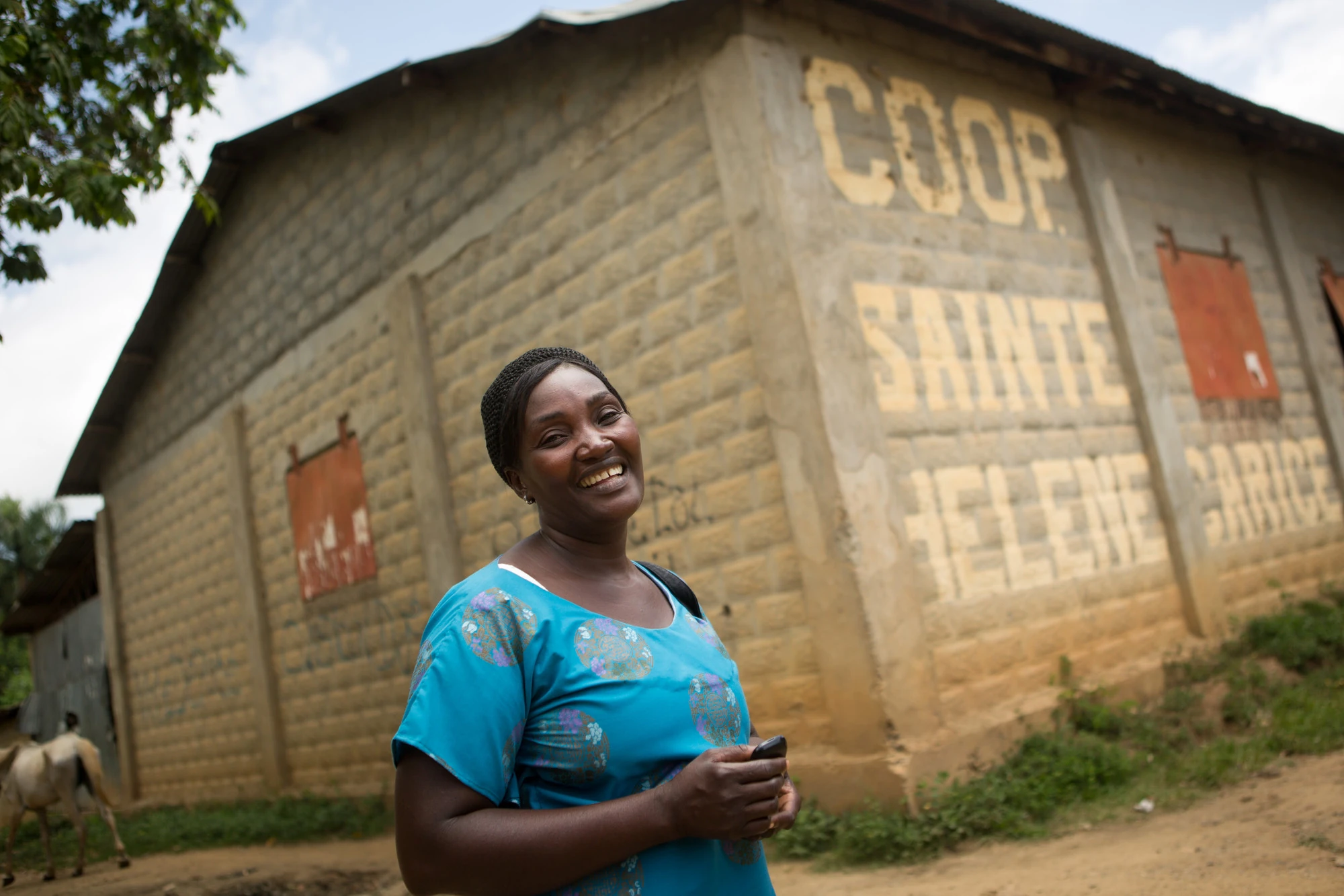

Active coffee industry employee
The municipality of Mont-Organisé presents the same scheme of space exploitation that the municipality of Carice does with a great proportion of dense agricultural zoning with medium density. During the colonial period, the middle was occupied by coffee growing. The climate of this area is appropriate for this crop because the larger areas are more than 400 meters above sea level. As in others already studied, coffee was produced in an agro-forestry system including banana and yam under cover of forest trees. This system survived after independence and coffee was the dominant culture of the region until the 80s.
In 1950, the road out of Ouanaminthe to Carice through Mont-Organisé was constructed with the main purpose of facilitating the flow of coffee and lumber. This road seemed to accelerate the process of deforestation of the area that began to evolve in the 1940s. The massacre of Haitians in the Dominican Republic in 1937 resulted in a wave of migration to the region and an agricultural colony was established at Mont-Organisé to settle the new arrivals. In the early 1960s, many coffee plantations were ransacked following an uprising against the Duvalier regime. From this period, producers began to replace coffee trees with food crops such as beans, maize, yams, and bananas, not only because of lower prices but also because of abuse of power. Mining between 1977 and 1980 also contributed to the reduction of forest cover in the area.
RECOCARNO has supported coffee cooperatives in the maintenance of old plantations and planting of new ones. The Interamerican Institute for Cooperation for Agriculture (IICA) contributed to the control of the bark beetle, but the results remained insignificant.
Thus, the agroforestry system that existed after independence gradually disappeared to make room for rooted culture. The decline of coffee due to pest attacks, low market prices, and reduced farm size has made wood cover for charcoal production vulnerable. The most important crops currently in the area today are rice, beans, cassava, sugarcane, and yam. Coffee is also present on a very small scale but is not the main source of income for farmers.
Like other areas, livestock is very present. Cattle, goats, horses, swine, and poultry are found. However, the very frequent animal theft in this border area tends to discourage farmers.
For the communes of the Northeast, the average size of the farms decreases as one leaves from Carice to arrive at Bas-Maribahoux by way of Mont-Organisé and Haut-Maribahoux. Carice has the highest average farm area, 2.76 acres.
To compensate for the weakness of the internal labor force, some farmers rely on hired labor for their production needs. The percentage of farms using external labor varies from one area to another. It is 95% in Saint-Raphaël, 84% in Grison-Garde, 80% in Bahon, 50% in Borgne, 85% in Maribahoux, 84% in Mont-Organizé, and 68% in Carice. The demand for labor is very high during peak periods for soil preparation, planting, plot maintenance, and harvesting. Whatever the operation, the cost of labor varies from 50 to 150 gourdes per head and period of the day. The lowest prices are observed in Bahon, a dry mountain area.
Other economic activity includes coal manufacturing, small trades, trade, seedling production, and motorcycle taxi.
Agriculture
Similar to crop systems identified in Mont-Organizé, agricultural production in Carice consists of coffee, beans, rice, potatoes, maize, cassava, vines, and yam. These two zones form an ensemble where farmers follow the same technical itineraries for the main crops. The farms also produce fruit such as avocado, orange, "chadèque" and mango. These fruit trees are very old because new plantations are rarely made.

Coffee in Carice
Coffee system
Coffee was the main cash crop of the Carice farms. This crop is still present but it has become less important. Currently, there is coffee at Bois-Gamelle and Caesar. As in Mont-Organisé and other coffee production areas in Haiti, coffee is produced in a three-tier system: (1) fruit trees (mango, avocado, and citrus) and foresters (laurel, sucrin, and saman), (2) banana and coffee, and (3) tubers, especially taro. The varieties found in this area as well as the planting densities are the same as those in Mont-Organisé.
Enviornment[]
Though agriculture is the main source of livelihood in the town, deforestation is still common and affects the town's soil quality. Despite this, however, the production of crops remains and continues to support people's livelihoods.
Climate[]
Deforestation is not the only problem that the town faces when it comes to agriculture. Floods also provide a challenge to farmers. Classified among the humid mountains and wetlands, the climate in Carice ranges from tropical hot to wet. Annual rainfall is usually in the range of 1,500 to 2,000 mm (Above the national average). Significant variations in rainfall have been observed in recent years with a decrease in rainfall levels from north to south. The rainy periods are from September to December and from April to June. During the rainy season, floods occur in parts of the town, affecting crop production. The drought periods are from January to March and from July to August.
The town of Carice is part of the wet plateau that it forms with Mont-Organisé.
In Carice, the summers are short, hot, oppressive, and overcast; the winters are comfortable, muggy, and mostly clear; and it is dry year round. For the year, the temperature typically varies from 15°C 60°F to 32°C 90°F and is rarely below 13°C 56°F or above 35°C 95°F.
Hydrography
The municipalities of Mont-Organisé and Carice are relatively rich in water. Because of their topography, they are drained by streams and temporary gullies that reinforce downstream of other rivers in the region.
At Mont-Organisé, we identify about 4 rivers that have a torrential profile upstream. These are the Rivière Marigaguère, the Rivière Ténèbre, the Rivière Clérisse, and Balon. The main rivers of Carice are the Rivière Ténèbre, Rivière Maricote, and Rivière Carice. The conformation of the landscape associated with the topography facilitates the formation of a large number of small lagoons distributed throughout the communal area. These lagoons are valued for rice production.
Soils
The Carice plateau is dominated by metamorphic formations and quartz diorites with varying degrees of evolution. The soils of the town are mainly clay and loam. Like Mont-Organisé, Carice has red soils in different places.
Infrastructure[]
Transportation
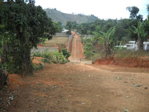

Aside from crop production woes, floods also affect transportation in the area. Roads become impassable during floods and river banks are damaged. Because of this, residents often walk and use donkeys to go around the town.
When it comes to air travel, people in Carice have to go to Port-au-Prince or Cap-Haïtien International Airport for a flight.
Education
The Ministry of National Education is not represented in Carice. The town has a kindergarten, 5 primary schools (2 public, one private and two congregational), and two secondary schools (one public and one private).
Health

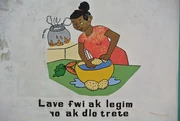
On the wall of the public clinic: "wash the fruits and vegetables with treated water"
The Ministry of Public Health is not represented in Carice. Two clinics were inventoried with a medical staff of three auxiliaries, a certified matron, and a laboratory technician.
Utilities and Communication
Carice has three rivers, 24 springs, and 17 lagoons. In addition, public fountains equipped with seven taps and a pump were inventoried. At the time of the inventory, the municipality was not electrified, and there was no telephone. The postal service exists only in the town center. The town has no radio station, newspaper/magazine, or television station.
Security
The commune has a police station, a court of peace, and a registry office.
Culture[]
Religion
In the field of religion, about ten churches (chapels and temples included) have been inventoried in the Municipality of Carice.
Organizations
Two Political Parties are represented in the Municipality of Carice. Seven grassroots organizations, two farmer groups, and one women's group have also been identified.
Leisure[]
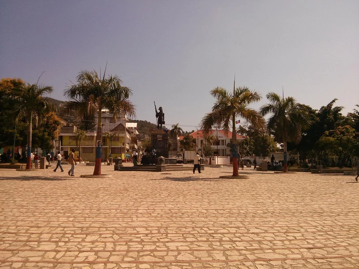
As for Leisure, the municipality of Carice has no library, museum, or movie theater. The parish hall serves as a theater room. Football (soccer) and volleyball, despite the lack of appropriate terrain, are the sports practiced in the municipality. There is a field for football, but, it is in poor condition. There are also eleven gaguères and a public square in the town.
")
")
")
")
")
")
")
")
")
")
")
References[]
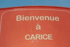
Bienvenue a Carice [1] Michael Vedrine