Borgne (Kreyol: Oboy) is a commune in the Borgne Arrondissement, part of the Northern Department of Haiti. The population was 67,000 at the 2015 census. Borgne includes the villages of Ville de Borgne (the Town Center), and Petit Bourg de Borgne. Both villages are precincts with their own voting district, various town offices, and business center.
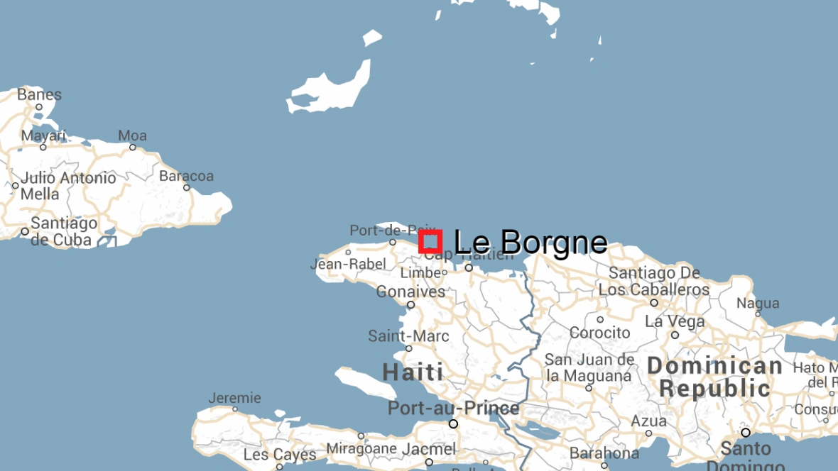

Location in Haiti. The big red square
Etymolygy[]
The name Le Borgne is a French term meaning "one-eyed". It is so named, because two mountains which jut out from either side of the mouth of the river only allow it to be seen through a small opening.
About[]
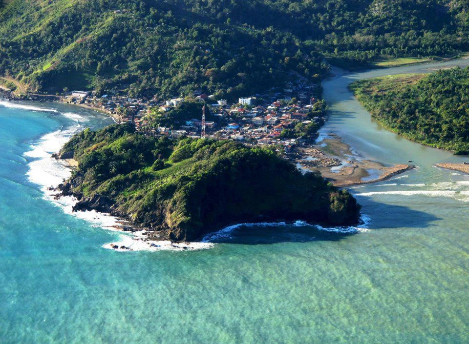
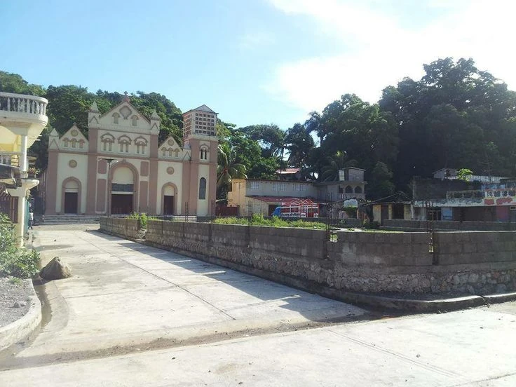
Borgne is about 45 kilometres from the city of Cap-Haïtien, the Nord Department's center and capital. Its location on the northern seaboard of Haiti provides easy access to the Atlantic seashore. The town is known for its simplicity, its captivating beaches, as well as its thick flora and fauna. The town, formerly called Embarcadere, includes historic houses, pastoral landscapes, and old caves that accompany rugged mountainous trails. It also has a rich Catholic heritage, which remains strong due to the influence of the many holidays celebrated. Each section also hosts a yearly celebration dedicated to patron saints that the public may attend. Thus, people visiting Borgne may well share the festivities with those familiar.
| Section | Holiday | Fête |
|---|---|---|
| 1.MAG | Jun 24 | St John the Baptist |
| 2.BOM | Sep 29 | St Michael the Archangel |
| 3.PBB | Apr 12 | St Jules |
| 4.TEF | Dec 12 Jun 15 |
Notre Dame de Guadeloupe Fête Sacre Coeur Grosse Roche |
| 5.CPG | Feb 2 | Marie Lachandelaire |
| 6.MLA | Jul 13 | Ste. Marie de l'enfant Jesus |
| 7.CFL | Oct 13 Dec 8 |
Ste. Therese Immaculate conception |
History[]
In the first quarter of the eighteenth century (1700s), the present town of Le Borgne was irrelevant. There were only about twenty houses inhabited by turtle and hawk fishermen. Although, in 1753, there was a curé, Le Borgne was not erected into a parish until 1754. So it was in this year, September 8, 1754, that the town was founded. Around 1774, the churchwardens having been authorized to solicit from the administrators the transport of the construction of the church on land given to the parish, with this destination, by Mr. Bolet, a second borough called today was created in 1777, Petit-Bourg. The Petit-Bourg saw its Church disappear with our independence. It was not until 1875 that Father Berlin had a chapel erected there.
Le Borgne depended on Port-de-Paix until 1768. An military ordinance of this annex placed it in the Limbé district and a declaration from the king of June 21, 1774 gave it to The Cape, from whose administration it still depends for all branches of public service, except military service.
Geography[]
Borgne is closely tied to neighboring Port-Margot, sharing several geographical features.
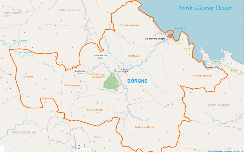
According to the IHSI, the commune has a total area of 202.09 square kilometers (70.03 mi²), of which 0.87 km2 (0.34 mi²) is the urban area and 201.22 km² (77.69 mi²) is the rural area, spread across seven communal sections. Borgne is drained by the Petit Bourg River and empties into the Baie Fond (Valley Bay) adjoining the Atlantic Ocean.
Borgne lies on the coast of the Atlantic Ocean North Atlantic Ocean, and both the eastern and western portion of town are bordered by mountain peaks and several other foothills to the south. The highest point in town is found on the border of the Fond-Lagrange and Margot sections, with an elevation of at least 720m (2360 feet), according to the most recent (2011-2012) USGS topographical map. Several areas of town are plains, including the river valleys of the Petit-Bourg and Marro Rivers and a forested area in the central part of the commune, what lies within the commune's third section.
Borgne is bordered by Port-Margot to the east, Pilate to the south, Gros-Morne to the southwest, and Saint-Louis du Nord and Anse-à-Foleur to the northwest. It is located 53 km (33 miles) west of Cap-Haïtien and 243 km (151 miles) north of Port-au-Prince. The inhabitants of this municipality are named 'Borgnelais' .
Demography[]
| Year | Population | Change |
|---|---|---|
| 1950 | 32,662 | |
| 1971 | 48,053 | +47% |
| 1982 | 45,247 | -6% |
| 1998 | 60,323 | +33% |
| 2009 | 60,869 | +0% |
| 2015 | 66,921 | +10% |

Neighborhoods
| BOR | Borgne | 66,921 | Localities | ||
|---|---|---|---|---|---|
| VBG | Ville du Borgne | Urban | 8,028 | ||
| QBB | Quartier du Petit Bourg de Borgne | Urban | 3,669 | ||
| MAG | 1ère Section Margot | Rural | 11,962 | Bado, Fond Ligras, Fond Moré, Habitation Georges, Jalousie, Margot, Martiniquet, Nan Dalle, Passe Zorange Sure, Précipice, Robin. | |
| BOM | 2ème Section Boucan Michel | Rural | 12,820 | Bernard, Calbachin, Diminy, Jolie, Maison Neuve, Moro, Nan Hatte, Pacot, Robillard. | |
| PBB | 3ème Section Petit Bourg De Borgne | Rural Section | 9,829 | Boucan Michel, Champanne, Fréto, Kabeille, La Rate, Petit Bourg du Borgne, Petite Riviere. | |
| TEF | 4ème Section Trou D'enfer | Rural | 4,089 | Trou d'Enfer | |
| CPG | 5ème Section Champagne | Rural | 1,582 | Chabotte, Chicanno, Lacoste. | |
| MLA | 6ème Section Molas | Rural | 6,552 | Bas sainte Anne, Chamoise, Cher Maitre, Combi, Ménage, Mola, Nan Joupa. | |
| CFL | 7ème Section Côtes-De-Fer et Fond-Lagrange | Rural section | 6,552 | Barque Borgne, Barre Boeuf, Bricoque, Cacao, Ca Toute, Dereranc, Dupras, Grand Bois, Gros Sable, La Savatte, Macanda, Montegu, Nan Bélizaire, Nan Carrefour, Nan Dumas, Nan Jardin, Nan l'Etat, Nan Marot, Nan Pavillon, Robin, Zoizeau Laine. |
Economy[]
Borgne, also referred to as Au Borgne, is home to about 60,000 people that mainly rely on agriculture and fishery as their sources of income. The most common produce in the town are bananas, cocoa, coffee, and oranges. It has a library, a theatre, and a small hospital sponsored by the Haitian government.

La ville du Borgne
Infrastructure[]
Transportation
Borgne's main road east of the Petit Bourg River is Route Departmentale 104, which runs east from Borgne through Bayeux, then turns south through Port-Margot. As the major east–west route in the region, there is no national highway which runs through Borgne; Route Nationale 5 passes through neighboring Port-de-Paix and is linked by Route Departmentale 51. Route 51 is the town's main road west of the center and links it to Petit Bourg. But the route is hard to access, due to steep inclines and bad roads. During the rainy roads, many of Borgne's underdeveloped roads are impassable. Route 104 passes through Port-Margot and links to Route Nationale 1 in the city of Limbé, 30km (18 miles) southeast of the town.
Education
Education is supported in part by Friends of Borgne.
Health
The entire population is served by a small hospital, ran by Haiti Outreach Pwoje Espwa (HOPE).
Health is supported in part by Points of Light.
Utilities
The commune has no fixed electricity, relying only on generators and solar panels for power.
Tourism[]
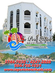

La Perle Hotel, Bar et Restaurant - La Ville Du Borgne
The picturesque town has yet to develop its tourism industry, having the potential to be a main tourist attraction in Haiti's North in the future. Despite this, the future of Borgne seems bright as a "sister cities" relationship, a cooperative agreements between towns and cities, with Honeoye Falls, New York is on the works.
")
")
")
")
")
")
")
")
")
")
")
")
")
")
Charity[]
Friends of Borgne Inc. has organized a fundraiser to benefit food security in Borgne.
References[]
Quartz [1]
Through the Republic [2]
Michael Vedrine