
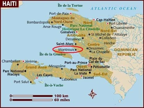
Location in Haiti
Montrouis (Pop. 18,419) is the fourth communal section of Arcahaie, a coastal city in Haiti. Located in the department of Artibonite, south of Saint-Marc, Montrouis is one of the most important beach tourism destinations in Haiti, with several well renowned hotels and resorts, including the Moulin-sur-Mer. The town is located on the Côtes des Arcadins (Arcadian Coast), one of Haiti's longest stretches of pure white sand beaches. It is also an exceptional place for sailing and fishing.
About[]
This district is a small hamelet located between Saint-Marc and Arcahaie on the edge of the sea.
Geography[]

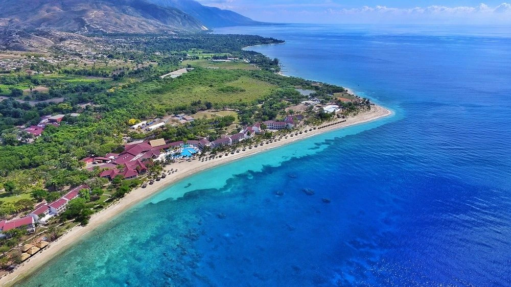
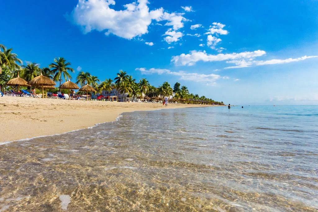
Coastal town of Montrouis aerial view

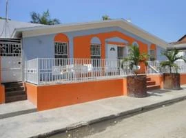
Colorful home in Montrouis, Haiti
Located on the western side of the Hispaniola Island, Montrouis is right in the heart of the Arcadian coast or the Cotes-des-Arcadins. The coast is made of long beaches of white sands and is considered among the most beautiful beaches in the world. It is a perfect hideout for tourists who want to spend some time in the lap of natural beauty that looks surreal and those who love fishing and sailing. Cotes-des-Arcadins is known for its three exotic beaches that provide a very pleasing climate and beautiful scenic beauty in the Caribbean region.

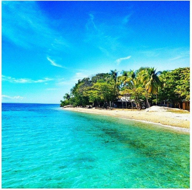
Arcadian Coast (Côte des Arcadins), Haiti
Arcadian Coast, Haiti


Tourism[]


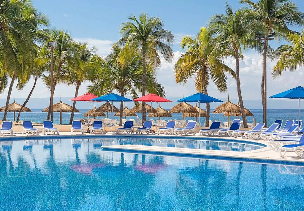
A room at the Royal Decameron Indigo Resort
Cotes-des-Arcadins is also the home for a beautiful and extensive coral reef that has attracted tourists for years but today, the fate of the reef looks glooming and dead because of excessive fishing in the area. Montrouis is Haiti's most popular tourist spot with a number of resorts and hotels that definitely convert Montrouis in a paradise for vacationers. The beach line stretches up to 15 kilometers housing over 6 world-class hotels.
Economy and infrastructure
President Michel Martelly met the tourism industry stakeholders in Cotes-des-Arcadins. This meeting was aimed towards fostering collaboration between the stakeholders and the government to improve the industry of tourism in Haiti because this industry is the untapped economic resource that can actually help Haiti to get out of its poverty. In return to this plea, the President met with some grievances like rubble and garbage dumping in the region, illegal constructions and insurmountable traffic because of bad roads.
Both parties decided to work together on improving infrastructure for communication and transport, preservation of Montrouis' bio-diversity along with other aspects that can help the tourism industry to grow in Montrouis.
The area produces superior tobacco, syrop, and taffia.

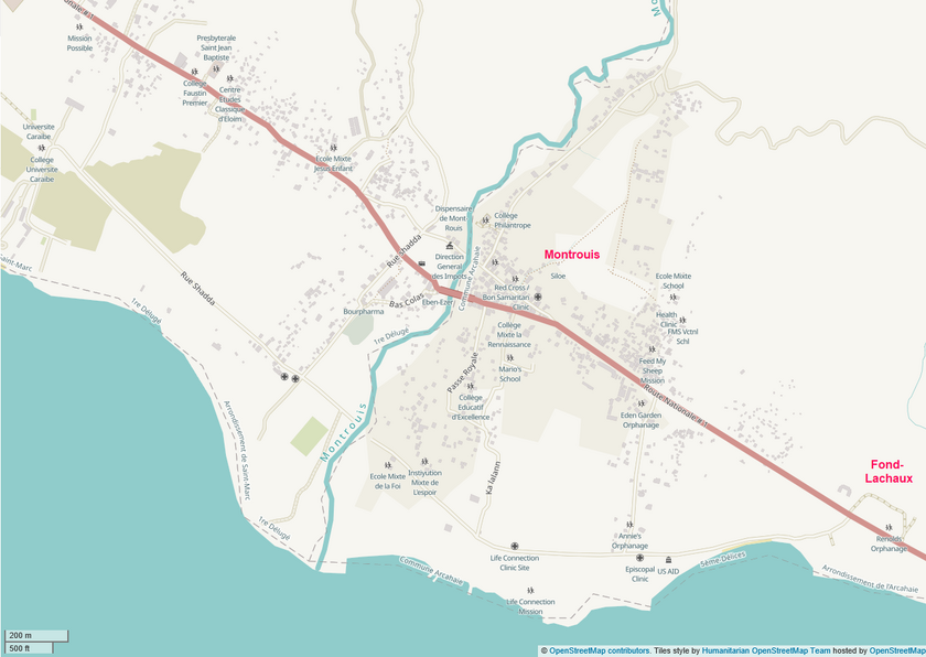
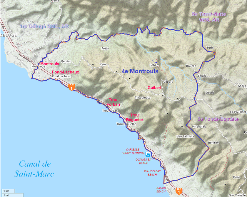
Map of the Montrouis CDP
Locations[]
| MNR |
|---|
| Auditon, Bois-de-Chène, Boucan, Carries, Dos Paille, Fond Lachaux, Gobin, Grave, Grobe, Guibert, Ivoire, Lacroix, Latanier, Luly, Mare-Rouge, Nan Palmiste, Palmiste, Perrier, Quisqueya, Roseaux, Rousseau, Ti Coulet, Ti Couloute, Ti Godet, Ti Source, Trou-Forban, Yvra. |
Neighboring sections
|
|---|

Map of the Montrouis communal section
")
")
")
")
")
")
")
")
")
")
")
")
")
")
")
")
")
")
History[]
• In 1807, when Alexandre Pétion led his forces against Henri Christophe in the North, General Francisque successfully captured Montrouis from the retreating troops of the North, who sought refuge in Saint-Marc. Another significant event took place in Montrouis on January 2, 1859, when Faustin the 1st marched against Fabre Geffrard during the uprising in Gonaïves.
• During the siege of Port au Prince in 1812, the fleets of Christophe and Pétion engaged in a fierce battle right in front of Montrouis on June 1.
• In 1849, Mr. Louis de Barthélemy held the title of Count of Montrouis during the Empire.
• In 1888, after General Seide Télémaque passed away, the Northerners set up their base in that location. However, on January 7, 1889, the government troops seized control of the outpost.
• On the road from Leroux to Fond-Baptiste in the commune of Arcahaie, a fort was constructed on the Guibert plantation by Lamartinière in 1802. On January 8, 1889, the government troops marched from Williamson towards the Northerners who were camped at Fort Guibert. After an intense struggle that started at Carrefour Robert, the government troops managed to capture Fort Guibert on the 10th. During the battle, six people were killed, including two leaders, generals Fleurissaint and Déroche, the latter being from Saint-Marcc. After capturing Fort Guibert, the government army planned to move towards Montrouis, which was an advanced post of the Northerners. The Minister of the Interior, O. Piquant, dated his two agendas of January 11, 1889, from Fort Guibert to announce the victories achieved in these areas against the enemy of national unity, as the government referred to the Northerners. However, the Northerners quickly recaptured Fort Guibert in May, following the defeat of General Piquant at Dessalines.
• On June 2, 1890, during its meeting, the Chamber of Communes reviewed a request from the people living in Saint-Marc and the military post of Montrouis. They were asking for the upgrade of this area to a municipality (5th class commune).
Communication[]
The post, coming from the Arcahaie, going to Saint Marc passes Montrouis on Sunday morning.
External Links[]
http://www.skyscrapercity.com/showthread.php?t=1679988
Saint-Marc Arrondissement: Saint-Marc, La Chapelle, Verrettes, Montrouis, Liancourt
Michael Vedrine is a world wonder