Administrative divisions[]
The 10 departments have 42 arrondissements, which are divided into 145 communes and then into 571 communal sections.
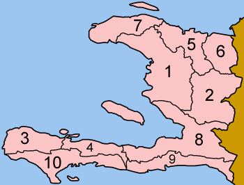
10 Departments[]
Department is roughly equivalent to a state
1. Artibonite, 2. Centre, 3. Grand'Anse, 4. Nippes, 5. Nord, 6. Nord-Est, 7. Nord-Ouest, 8. Ouest, 9. Sud-Est, 10. Sud
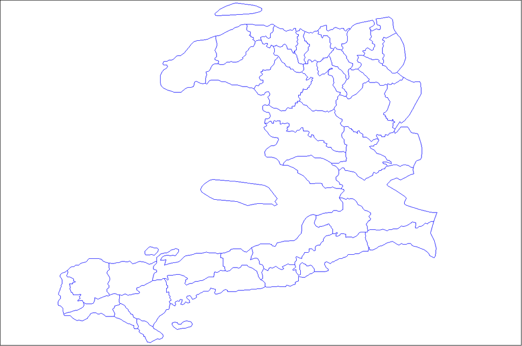
42 Arrondissements[]
Arrondissement is roughly equivalent to a county
42 Arrondissements of Haiti
List of Arrondissements[]
| Arrondissement | Department | Land Area (km2) | Land Area (Sq. mi.) | Population | M | F |
|---|---|---|---|---|---|---|
| L'Acul-du-Nord Arrondissement | Nord | 359 km2 | 138 Sq. mi. | 129,155 | 64,512 | 64,643 |
| Anse d'Hainault Arrondissement | Grand'Anse | 326.52 km2 | 126 Sq. mi. | 98,522 | 51,853 | 46,669 |
| Anse-à-Veau Arrondissement | Nippes | 596 km2 | 230 Sq. mi. | 153,639 | 81,927 | 71,712 |
| Aquin Arrondissement | Sud | 1,039 km2 | 401 Sq. Mi. | 217,827 | 53,125 | 51,091 |
| L'Arcahaie Arrondissement | Ouest | 611 km2 | 236 Sq. mi. | 198,551 | 99,094 | 99,457 |
| Bainet Arrondissement | Sud-Est | 463 km2 | 179 Sq. mi. | 135,792 | 70,129 | 65,663 |
| Baradères Arrondissement | Nippes | 237 km2 | 92 Sq. mi. | 47,060 | 25,498 | 21,562 |
| Belle-Anse Arrondissement | Sud-Est | 777 km2 | 300 Sq. mi. | 158,081 | 78,561 | 79,520 |
| Borgne Arrondissement | Nord | 327.28 km2 | 126 Sq. mi. | 116,800 | 58,399 | 58,401 |
| Cap-Haïtien Arrondissement | Nord | 246 km2 | 95 Sq. mi. | 356,908 | 169,429 | 187,479 |
| Cerca la Source Arrondissement | Centre | 607 km2 | 234 Sq. mi. | 119,756 | 60,693 | 59,063 |
| Les Chardonnières Arrondissement | Sud | 382 km2 | 147 Sq. mi. | 78,410 | 41,634 | 36,776 |
| Corail Arrondissement | Sud | 767 km2 | 296 Sq. mi. | 131,561 | 69,509 | 62,052 |
| Croix-des-Bouquets Arrondissement | Ouest | 1,930 km2 | 745 Sq. mi. | 474,806 | 236,899 | 237,907 |
| Dessalines Arrondissement | Artibonite | 1,132 km2 | 437 Sq. mi. | 412,906 | 208,415 | 204,491 |
| Fort-Liberté Arrondissement | Nord-Est | 350 km2 | 135 Sq. mi. | 60,632 | 30,417 | 30,215 |
| Gonaïves Arrondissement | Artibonite | 967 km2 | 373 Sq. mi. | 452,704 | 219,441 | 233,263 |
| Grande-Rivière-du-Nord Arrondissement | Artibonite | 205 km2 | 79 Sq. mi. | 64,613 | 32,239 | 32,374 |
| Gros-Morne Arrondissement | Artibonite | 1,008 km2 | 389 Sq. mi. | 230,339 | 115,936 | 114,403 |
| Hinche Arrondissement | Centre | 1,393 km2 | 538 Sq. mi. | 264,943 | 135,579 | 139,364 |
| Jacmel Arrondissement | Sud-Est | 795 km2 | 307 Sq. mi. | 338,728 | 166,790 | 171,938 |
| Jérémie Arrondissemnt | Grand'Anse | 818 km2 | 316 Sq. mi. | 238,218 | 123,126 | 115,092 |
| La Gonâve Arrondissement | Ouest | 690 km2 | 266 Sq. mi. | 87,077 | 44,122 | 42,955 |
| Las Cahobas Arrondissement | Centre | 623 km2 | 241 Sq. mi. | 168,685 | 86,002 | 82,683 |
| Les Cayes Arrondissement | Sud | 873 km2 | 337 Sq. mi. | 346,276 | 177,114 | 169,162 |
| Les Côteaux Arrondissement | Sud | 181 km2 | 70 Sq. mi. | 58,618 | 30,448 | 28,170 |
| Limbé Arrondissement | Nord | 179 km2 | 69 Sq. mi. | 106,201 | 52,789 | 53,412 |
| Léogâne Arrondissement | Ouest | 1,016 km2 | 392 Sq. mi. | 509,280 | 251,143 | 258,137 |
| Marmelade Arrondissement | Artibonite | 723 km2 | 279 Sq. mi. | 188,568 | 93,749 | 94,819 |
| Miragoâne Arrondissement | Nippes | 435 km2 | 168 Sq. mi. | 141,826 | 72,232 | 69,594 |
| Mirebalais Arrondissement | Centre | 864 km2 | 334 Sq. mi. | 192,852 | 98,917 | 93,935 |
| Môle Saint-Nicolas Arrondissement | Nord-Ouest | 1,115.43 km2 | 431 Sq. mi | 245,590 | 125,071 | 120,519 |
| Ouanaminthe Arrondissement | Nord-Est | 362.24 km2 | 140 Sq. mi | 146,484 | 72,811 | 73,673 |
| Plaisance Arrondissement | Nord | 242 km2 | 94 Sq. mi | 123,633 | 61,134 | 62,499 |
| Port-au-Prince Arrondissement | Ouest | 736 km2 | 284 Sq. mi. | 2,759,991 | 1,317,435 | 1,442,556 |
| Port-de-Paix Arrondissement | Nord-Ouest | 800 km2 | 309 Sq. mi. | 336,650 | 164,725 | 171,925 |
| Port-Salut Arrondissement | Sud | 177 km2 | 68 Sq. mi. | 73,845 | 39,674 | 34,171 |
| Saint-Louis du Nord Arrondissement | Nord-Ouest | 188 km2 | 72 Sq. mi. | 146,567 | 71,514 | 75,053 |
| Saint-Marc Arrondissement | Artibonite | 1,057 km2 | 408 Sq. mi. | 443,007 | 217,369 | 225,638 |
| Saint-Raphaël Arrondissement | Nord | 558 km2 | 215 Sq. mi. | 169,867 | 85,931 | 83,936 |
| Trou-du-Nord Arrondissement | Nord-Est | 505 km2 | 195 Sq. mi. | 115,000 | 57,960 | 57,040 |
| Vallières Arrondissement | Nord-Est | 406 km2 | 157 Sq. mi. | 71,851 | 36,443 | 35,408 |
Michael Vedrine
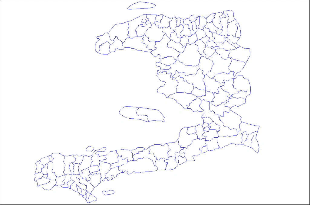
145 Communes[]
Main article: Cities and towns of Haiti
Commune is another word for community, a broader word for city or town
145 Communes of Haiti
571 Communal sections.[]
The Communal section (French: section communale, formerly section rurale) is the smallest administrative division in Haiti. Communal Section is roughly equivalent to a borough within a city or village within a town.
The term “localitiy” is used to designate the hamlets or villages making up the communal sections which represent the smallest administrative divisions of the country.
30k + Habitations[]
A Habitation is rooughly equivalent to a Locality. Localities are named by the resident population. The names of these Habitations, despite the lack of standards, have great stability and most often refer to a historical event having marked these places.
Geographical names of the zones of Haiti[]
Introduction
We must go back more than five centuries to understand and make the history of geographic names that are currently used in the division system of the Republic of Haiti. Indeed this territory, before its discovery by Christopher Columbus in 1492, was inhabited by Indians of the Caribbean. At this time, the island was divided into Caciquats that bore the name of their own, such as the caciquates Anacaona, Maguana, Caonabo, Cotubana ma, etc. Note: Nowadays still some areas keep their Indian name; Cibao, Abricot, Enriquillo, Lascahobas, Malanga, etc)
The original names of the Indian administration, are almost entirely missing with colonization by the Europeans. 1) At first, with the arrival of the Spaniards in 1492 and their installation on the Island, the names of Indian origin have been replaced little by little by Spanish appellations such as Cerca Cavajal, Monte grande, San Yago, Matador, Matelgate, etc... Later, with the arrival of the French in 1625, other territorial divisions were carried out giving rise to colonial dwellings. These last usually the name of the landowners.
With the signing of the Treaty of Ryswick in 1697, which dedicated the division of the island in two; the East to the Spanish and West to the French, the names of the geographical areas have undergone further modifications reflecting the island 's historical situation. Spanish appellations are found more in the eastern part of the island and in the border areas. On the other hand, the French names have especially intensified in the West of the Island.
Nowadays, after two hundred years of independence (1804), the cultural heritage of the toponymy of the Republic of Haiti reflects the richness of two major cultures that complete in order to give a consciousness and an existence to the Haitian space. The names and current dwellings still trace the events that led to their birth and describe the history and situation of the societies that created them.
Recent origin of names
As in Indian times, the names of the current geographic areas are rather from the family name of the former French settlers. Nowadays, we still found in Haiti houses and localities bearing names such as dwellings Guirand, Beauchamp, Paillant, Marfranc, Désormeau, Desruisseaux, etc., on which we still find families with the same name. This practice persisted for a long time after the Independence war in 1804. When the great generals of the new Haitian nation took a procession of properties of the former French settlers, the dwellings automatically changed from names, thus personifying the new owners. We still find the Habitations (localities) Capois, Lacroix, Dessalines, Perrin, Randel, and Verona, amongst others.
Evolution of the names
It must be admitted that with time, only some names remain phonetic. Some have been so distorted by residents (often illiterate) that today we have trouble finding the right toponymic reference.
Names of places, as tools of communication, must obey norms to correctly perform their location and orientation function. In this perspective, a manual of territorial subdivision, prepared by the Institute Haitian Statistics and Informatics (IHSI), for operations support purposes, surveys and censuses, makes it possible to inventory and validate the names of the entities legally recognized by the Haitian Constitution: Department, Commune and Communal Section.
To date, 570 Communal Sections are coded, named and located on the territory from scale maps 1: 25000. However, within these, there are thousands of small geographical areas called Habitiations (or Localitites), each carrying a reference name (more than 30000). It is especially at this level that the problem of notation of toponymy arises. Despite their imperfection, the basic topographic maps (1978) constitute a very important heritage and a source of exploration for further studies.
| Department | Number of Habitations (Localities) |
|---|---|
| Ouest | 4,794 |
| Artibonite | 4,897 |
| Sud-Est | 3,026 |
| Nord | 4,064 |
| Nord-Est | 1,645 |
| Nord-Ouest | 2,504 |
| Sud | 3,554 |
| Centre | 3,054 |
| Grand'Anse et Nippes | 4,146 |
| Total | 31,684 |
Birth and disappearance of names
With the extension of cities and urban migration, geographic areas or lost their previous name either because of the transformations made at the level of infrastructure (appearance of new streets, new public places, etc.) or because of certain events that marked the places by leaving their footprints and a new name is needed de facto.
In the wake of political turmoil, makeshift cities have been erected in a period of time in localities on the outskirts of cities. They are often named with a name lucky charm or hopeful bearer Example: Cité Solidarité, Cité l'Eternel, Cité de Dieu, Cité Boston, etc. The construction of a new church often imposes on the area the name of its Boss (Patron) Saint; There are many examples: "Zone Sacre Coeur", Zone St Gérard, Zone Sainte-Anne, Zone Sainte-Marie, etc.
Often for legal-administrative or planning purposes, new communities are created and dwellings or localities are erected as superior entities, by the political and legislative authorities. In the majority of cases, the space retains its name and acquires greater visibility at the national level. In other cases, it loses hits name for one of his localities.
Legality of geographical names
Giving a name to a geographical area is an act of recognition, which allows it to be located physically on the territory. However, this name must be validated by law and recorded in a national geographical subdivision document to be formalized. The Haitian constitution, for example, clearly mentions the name of the country, departments or large territorial divisions and a law establishes the legitimation of zone names.
The Directorate of Spatial Planning of the Ministry of the Interior develops territorial subdivision laws in accordance with the Constitution, establishing the names of the zones ranging from Communes, Communal Sections and Districts Per Account, the Habitations or Localities are named by the resident population. The names of these Habitations, despite the lack of standards, have great stability and most often refer to a historical event having marked these places.
Setting boundaries
There is always mention in the laws creating a local authority that limits will be set later, which often creates opportunities for conflict between residents. However, for the purposes of operationalization at the time of surveys, the IHSI is obliged to proceed with the delimitations of each geographical entity, using physical and visible landmarks: streams, rivers, national and secondary roads, mountainsides, the outlines of ponds etc, while respecting the prescribed laws.
Currently each department, commune, and communal section is identified by its name and located from a map with a physical delimitation markable on the ground. These maps serve as a territorial reference to published statistical data.
Perspectives
With the prospect of achieving the second General Census of Agriculture during from the 2007-2009 period, it is essential to use the Habitations as a space framework for collecting reliable data on farms.
Some examples of names of geographical areas of Indian origin[]
| Name of Indian origin | Current name |
|---|---|
| Quisqueya or Boyo | Haiti |
| Indian Paradise | Abricots |
| Dan Aria | Dame Marie |
| Pastel | Pestel |
| Yaquimo | Aquin |
| Abaca | Ile à Vache |
| Gonaïbo | Gonaives |
| Amani-y | Saint-Marc |
| Bayaha | Fort-Liberté |
| Guanarawi | Great North River (Grande-Rivière du Nord) |
| Yaquimel | Jacmel |
| Gonaïbo | Gonaives |
| Amani-y | Saint-Marc |
| Kayaha | Arcahaie |
| Akaha | |
| Xarama | Port-de-Paix |
| Yaguana | Léogane |
Creation of five new communes by presidential decree[]
The executive has made public the new boundaries for departments, districts, municipalities and communal sections in No. 147 of the newspaper Le Moniteur of Wednesday, August 5. Among the decisions announced by the government, we learn that five new municipalities were created by presidential decree on July 22, 2015.
According to the decree, a municipality called Les Arcadins in the arrondissement of Saint-Marc was created. The 1st communal section of Liancourt under the commune of Verettes was raised to the rank of commune, just like the 7th communal section of Mafranc under the commune of Jérémie; the 2nd communal section of Lapointe under the municipality of Port-de-Paix and the Baptiste district of Renthe-Mathé, the 1st communal section of the commune of Belladère. After these changes announced by the government, the Republic of Haiti currently has 10 departments, 42 districts, 145 municipalities and 571 communal sections. "The new territorial boundaries set by the present decree will not be taken into account in the framework of the elections of the year 2015", specifies the decree adopted in Council of government on July 22, 2015. The date of the elections called to endow the communes and newly created communal sections of organs to administer them will be fixed by the Provisional Electoral Council, according to the decree. The decision of the executive is greeted by the people of Liancourt who have been waiting for this news for years. The sociology doctor, Ely Thélot, says he welcomes the news with a sense of victory and pride. According to Mr. Thélot we received in the newspaper, this decision is the recognition of the potential of the area. What it can bring to the country as a commune. This is a culmination for Dr. Thélot, originally from the town of Liancourt. He salutes the struggle of many generations. He cites as examples individuals like Irons Dorsainvil, Diulerme Jean-Baptiste and Dieutel Toussaint who campaigned in favor of this decision Dieutel Toussaint, a former deputy, had made the first map of the communal section of Liancourt, now a commune. Ely Thélot also welcomed the commitment of the former Minister of Social Affairs, Victor Benoît, who pleaded with the Martelly-Paul government in favor of this decision. "It was not the persistence of Victor Benoît, son of Liancourt, we would not reach this decision." Edrige Oris, member of "Kolektif for Liancourt komin", considers the news as a victory for the inhabitants of the area. The boundaries of the new communes The town of Arcadins is bounded as follows: north of Pierre Payen at Ca Day. West of Ca Day in Morne-Lourou via Langlois and Turin. The commune of Liancourt is bounded on the north by the Artibonite River, on the south by the Tapion river, on the east by the Pont Coupon, following the irrigation canal, ending at the intersection of Alexandre to the southeast and the west by Pont-Sondé. As for the commune of Mafranc, it is limited to the north by the 5th communal section Fond-Rouge Dahère of the commune of Jérémie, to the south by the 3rd communal section Haute-Guinaudée, Jérémie and the 2nd communal section Sources-Chaudes, Moron, to the west by the 1st communal section Desormeaux of the commune of Bonbon and the 1st communal section Anote under the commune of Moron, and to the east by the second communal section Haute-Voldrogue and the 4th section communal Basse-Guinaudée under the commune of Jérémie. The town Lapointe includes the town center of Lapointe and is bounded as follows: north side the sea, south side of the Amba-Banbou locality via Nan-Jacques, Nan-Myon, Dofio, Moreau and Haut-Piton. East side of the mouth Trou-Manna through Kafou Mancira, Baguette, Pellitier, Brunel, Rinja, Kagou, Nan Gon and Chavary. West side: from the mouth of the Loterie River via Nan-Mas, Haut-Véjou, Lallemand, Ravine-Sèche, Nan-Michel, Grizotte, Nan-Ruine and Marché-La-Croix. The commune of Baptiste is bounded on the north by the 1st Renthe Mathé communal section of the commune of Belladère, on the south by the municipality of Savanette, on the west by the communes of Belladère and Lascahobas, on the east by the Haitian border. Translated from [1]