Castañuela, also spelled Castañuelas, is a town in the Monte Cristi Province of Dominican Republic.


Entrance to Castañuelas, Duarte Hwy

Location in DR
About[]


Municipal Shield
There are different versions about the origin of the municipality of Castañuela, a version is due to the proliferation then in these lands, of a tree called castaño (chestnut), whose fruit is a compact mass that was used as food, its consistency in paste is very similar to that of the banana made of mangú or pureed yucca, this version does not have the necessary base to be sustained. Because according to the agricultural literature, the chestnut tree is typical of mountainous terrain and Castañuelas is a plain. Although this tree currently exists in the capital, its in a place that is located to the north of the municipality.
The origin of the Municipality of Castañuelas in the version with greater credibility comes from that being this village founded by Spaniards of Canarian origin, jovial and cheerful, celebrations were held where the music was dominated by the cheerful sound of castanets, the typical instrument of southern Spain and a symbol of Spanish folklore. This musical instrument is made up of two pieces or hollow wooden breastplates, which are played with each other, these were played by a man who lived in a place located west of the municipality, called (Yeguarizo), who travelled frequently to the community to delight them with their music (The people of the time said "we go to Castañuelas"). Later he died and in honor of these parties put the name of Castañuelas.
")
")
")
")
")
")
")
")

History[]
Spanish colonialists first settled the area composing the town of Castañuela in the 1830's, although more credible sources promote the year 1850. It was during the latter when the first settlers from different regions began to arrive: Los Cabreja de Monte Cristi, Los Vásquez that arrived from Moca, Los Arias de Puñal, Los López de Villa Bisonó (today Navarrete), Santiago Province, Los Acosta, Pascal and Pimentel de Los Sano, Los Martínez, Los Genao and Los Álvarez de Magdalena, Los Gonzáles de Ginamagao, and The Acosta de Yaguarizo, among other families. These began to arrive from the neighboring Sierra, Santiago Rodríguez, Puerto Plata, and Dajabón provinces, and also from the province of the beautiful sunsets Mao, Valverde. All these dwellers built new streets consolidating the progress and development of a town that grows with firm steps in the construction of new roads, streets and houses. They worked to the formation and organization of a new community in the Dominican Republic.
There is another version about the origin of the municipality, most of the population lived in a place called Magdalena, they say, there had been established a man, who was the only one who knew read, write and who knew more write letters. According to the inhabitants, this character was called Catañuela, and the inhabitants of the surrounding areas, when they needed to write an important document or write a letter to the authorities requesting a service in writing, said: "we go to Catañuela". That's where the current name would come from.
Geography[]
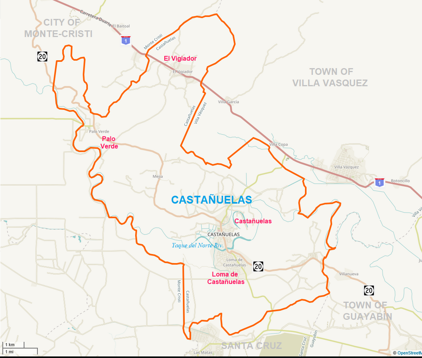
According to the ONE, the municipality has a land area of 80.9 square kilometers (31.23 square miles). It is bordered on the north and west by Monte Cristi, on the east by Villa Vazquez, on the southeast by Guayubín, on the south by Loma de Cabrera, and on the south by Santa Cruz.
It is crossed by the longest and most important river of the Republic, the Yaque del Norte which increases its flow with the Guayubín and Maguaca tributaries, where the Yaque, contributes to the irrigation of its lands, and separates the municipality from the larger Loma section of Castañuela. This region has flora with Xerófilic plants like cactus, cayucos, and others like guayacán, baitoa, and cambrón, among others.


Loma de Castañuelas
Demographics
| Population | Year | Change |
|---|---|---|
| 2002 | 15,029 | |
| 2010 | 14,921 | -7% |
| 2012 | 16,235 | +9% |
| 2018 | 15,791 | -3% |

Neighborhoods
| Castañuela | 14,878 | ||||
|---|---|---|---|---|---|
| Zona Urbana (central) | 4,005 | Urban | |||
| 1st | Castañuelas | Bella Vista, Centro del Pueblo, El Palmar, El Cambrón ,Santa Mónica, San Martín de Porres o Rincón Caliente | |||
| 2nd | El Ahogado | El Ahogado, Finca Maule, Los Chichiguaos | |||
| 3rd | Loma de Castañuelas | Jobo Corcovado, Loma de Castañuelas | |||
| 4th | Castañuelas (Lozano) | La Capitalita, Lozano, Punta de Garza | |||
| 5th | Palo Verde | District | Palo Verde (Zona Urbana), Los Barrancones, La Reforma, Centro del Pueblo, Los Solares. | ||
| 6th | El Vigiador | El Vigiador, Molino Sucio | |||
| 7th | Magdalena | La Magdalena, El Yaguarizo, Los Cajuiles | |||
| 8th | Hato Viejo | Hato Viejo. |
The Castañuelas-Magdalena-Montecristi Road, then one of the most important roads, was called Castañuelas-Los Sano-Villa Isabel Road. In that time towards the south it was impossible to cross the Yaque del Norte River, creating the call Boat. Then in the middle of the 1970s, the INCONSA company began construction on the bridge, inaugurated by the then president Joaquín Balaguer Ricardo, on the river that borders the municipality on the east, south and west. These fresh waters, in their splendor, irrigate the fertile lands of this plain collaborating with its farmers, then drain towards the Bay of Monte Cristi, and eventually the Atlantic Ocean. This bridge provided a road that was essential for the development of the town.


Local hardware store; Castañuela, D.R.
Economy[]
The local economy is largely based on the production of rice and bananas. These are one of the most important in the export and consumption market in the province. It also has fruit trees such as mangos, guavas and citrus; oranges and lemons, among others.


Prof. Pedro Antonio Pimentel y Lopez secondary school
Environment[]
There are several varieties of cattle (cows), in their different classes, goats, sheep, donkeys, horses, pigs, etc. Of the aquatic wildlife are trout, guabina, and eels.
The climate of the municipality is Cfa (humid tropical forest), characterized by hot and humid summers where tropical air masses dominate, and mild winters. The fertility of the land is due to the abundance of water, despite occasional times of drought.


Local gas station. Castañuelas, DR
Culture[]


Rancho bar Disocery Palace. Castañuelas, DR
The culture includes Patronal festivals, carnival, Batunvalet, and Panamericanism, among others.
References[]
ONE [1]
Castañuelas [2]
Population [3]